Maps
It allows to add a new map based on the requirement and view the added or existing list of locally imported from storage under MY MAPS tab. The added list are provided with few functions like to view, zoom, share and delete.
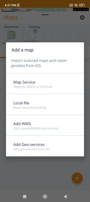
Add a Map
Click on the Maps icon located at the bottom-right of the main screen that displays the method of adding maps. It enables to import scanned map and raster data from GIS. There are three functions under Add a Map:
Map Service
Local File
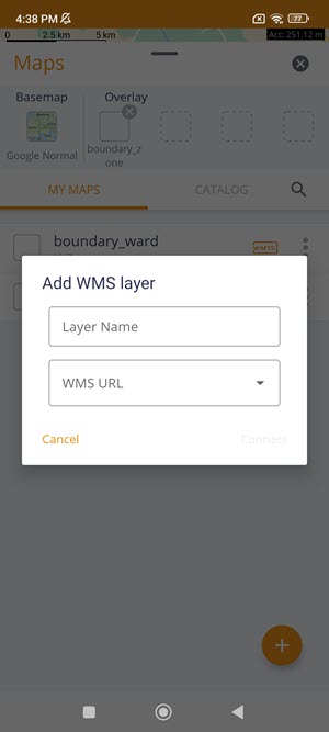
Add WMS
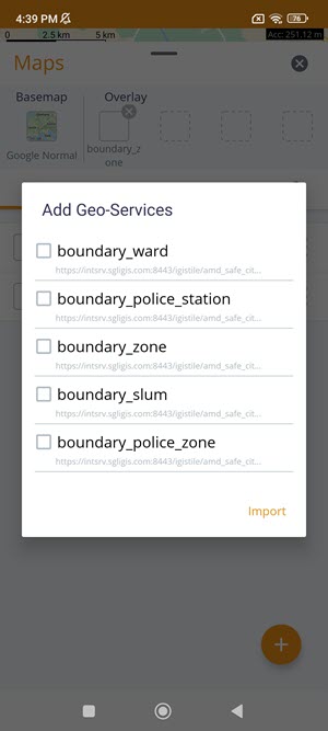
Add Geo-services
To add a map, click on the icon:
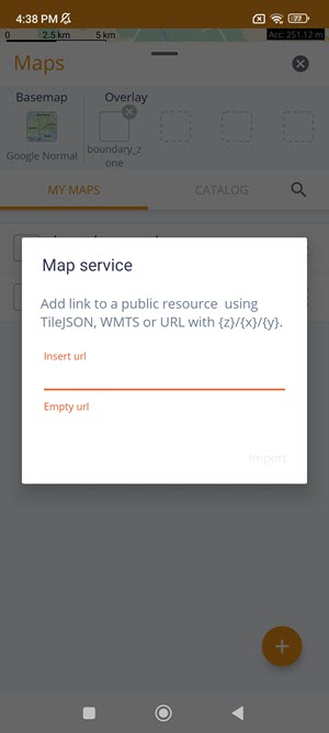
Map Service – Add a link to a public resource using TileJSON, WMTS or URL with {z}/{x}/{y}.
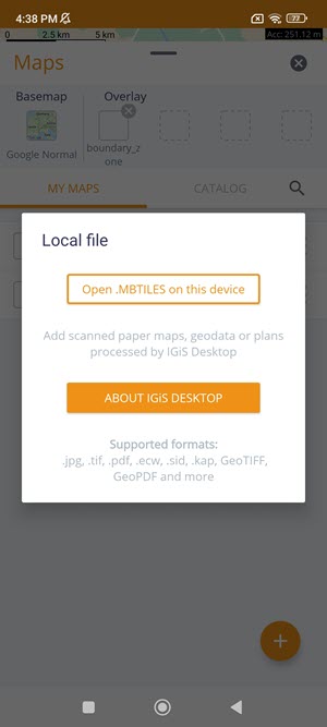
Local File – Add a local file available on a mobile device. Open .MBTILES on this device- add a scanned paper maps, geodata or plans processed by IGiS Desktop.
Supported formats: .jpg, .tif, .pdf, .ecw, .sid, .kap, .GeoTIFF, .GeoPDF, and more.
Add WMS Layer – Specify the WMS Layer name and WMS URL to connect.
Add Geo-services- Select a local file from the Geo-services list which is imported under Maps.